Geotagging is where you add geographical identification metadata to your photos or video. If you have ever uploaded smartphone or drone images to Adobe Lightroom, you might have noticed this rather snazzy feature.
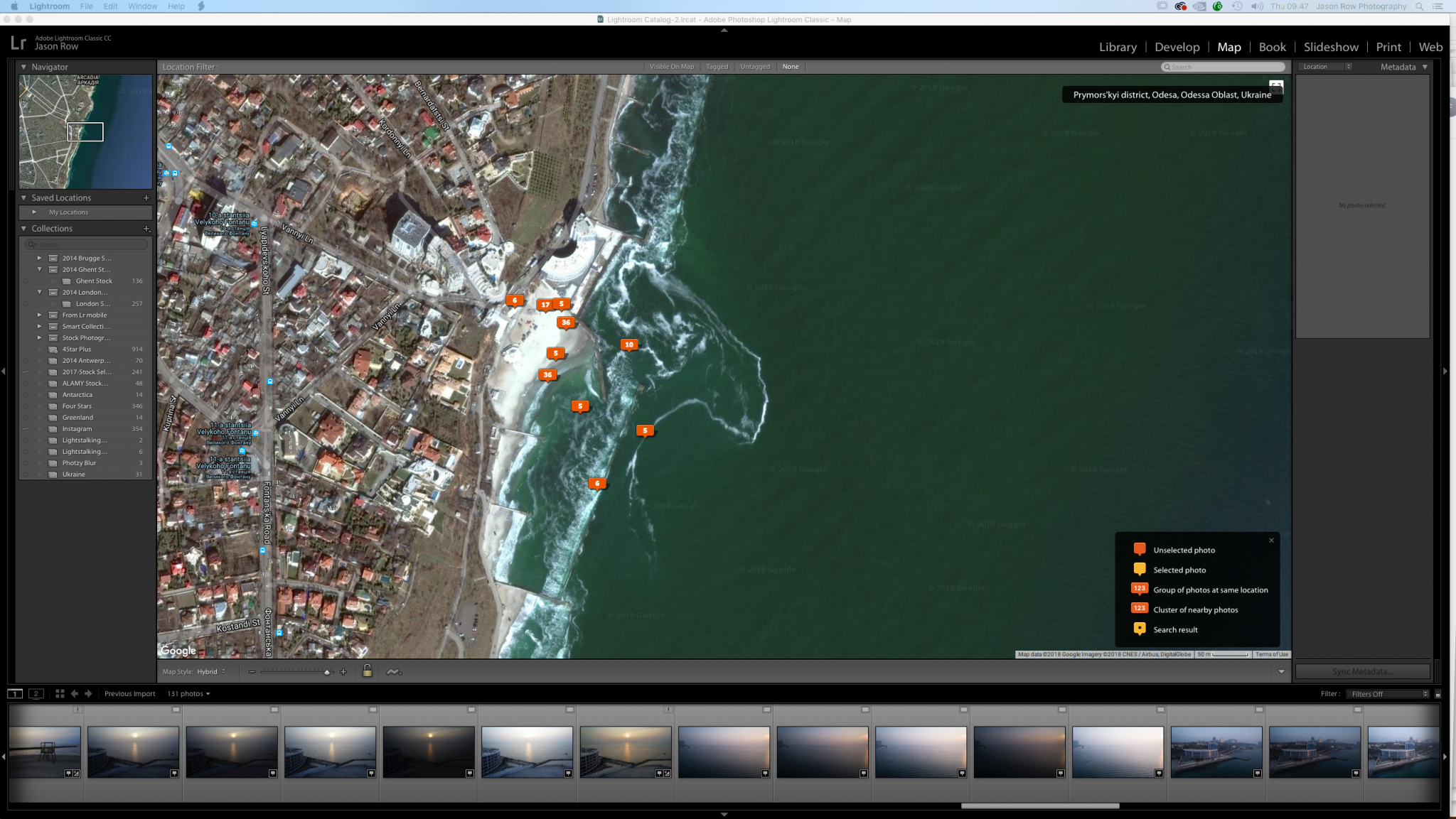
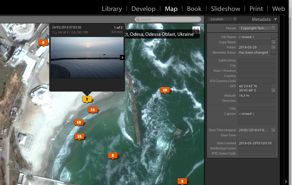
If you go to the Map tab, the third tab along, you can see markers showing a very accurate representation of where your photos were taken. Click an individual marker and it will reveal the shot taken in that position.
Geotagging is a very useful feature to have. Unfortunately, outside of drones, smartphones and upper-end cameras GPS location is not often built into cameras.
However, with the use of OEM or third-party apps, it is still possible to add geotagging to your DSLR or Mirrorless images.
Here are 3 tips to understanding and using geotagging
1. Why You Should Geotag
There are a few reasons why you might want to geotag your images the primary one being as an “aide-memoire”.
Many of us will upload out images to Lightroom or similar and then when we come to look at them a few months later, struggle to think where it was taken. While we might remember the city or even street, we may not remember the specific location. With geotagging, we can zoom into the exact point we took the photo and identify the subject matter.
Geotagging is also very useful for those that like to pre-plan a shoot. You can visit the location in any weather and record the best angles using a smartphone. When you return you can use the geotagged location to guide you the best shooting points.
For photographers that like to submit images for stock agencies, geotagging can be invaluable. Not only for adding the direct location to the metadata but also for researching the details of the surrounding area for the keywords.
2. How Does Geotagging Work?
Quite simply the camera, drone, or phone locks onto the GPS and in some cases the GLONASS satellite location system and triangulates the location of the device.
That data is then recorded in the shot’s metadata as GPS coordinates. Often the altitude above sea level is also recorded, particularly useful in drone images. GPS is part of the standard EXIF data built into image file types including JPEG and RAW formats.
3. Here's How To Geotag Your Images
As mentioned above, a significant number of cameras do not have a built-in GPS function. There are however a number of workarounds that allow you to get GPD data into your photos. Primarily these are based around the use of a smartphone and app. Even budget level smartphones will often have a GPS locator built in and by using this in combination with a specialist app we can accurately record the location in which we take each shot.
For this to work, the smartphone has to synchronize with the camera somehow. The most common way that this is done is via synchronizing time. Before you are about to start a shoot, you synchronize the time of your camera to the exact time on your phone.
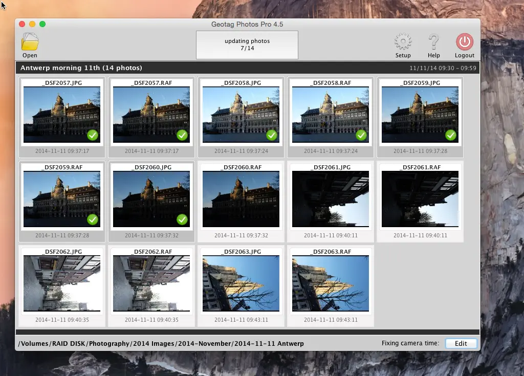
As phones often use Internet time they are very accurate. You now activate the app it will start to record your exact route through the shoot. When you get home and upload the shoot, you need to synchronize the images to the data recorded by the app. This is commonly done using a desktop app provided with the smartphone app and will embed the GPS coordinates into the EXIF data of each image.
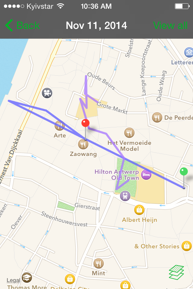
There are a number of apps out there that will do this, both on Android and IOS. Some are paid and offer extra functionality, others free and limited or supported by adverts.
Many Mirrorless cameras offer an alternative. As these cameras often include a remote app for live viewing and shooting over wifi, the camera and app automatically sync and the GPS data is recorded by the app. You will still need to synchronize the images and app at home before you upload them to Lightroom or similar.
Geotagging is an increasingly important part of the photographer’s workflow. At it’s most basic level its just a fun way to remember where you have been and what you have shot. Beyond that, it is a powerful tool for enthusiast and professional photographers alike.
It can help you accurately plan shoots or allow you to access important information about a very specific location you have shot. Best of all, its a very cheap tool to add to your photographic collection, most geotagging apps cost little more than a few dollars.
What’s not to love.

1 Comment
Geotagging is really useful for me to write my trip report. I can clearly know from where I had clicked the photograph.I do nature and wildlife photography